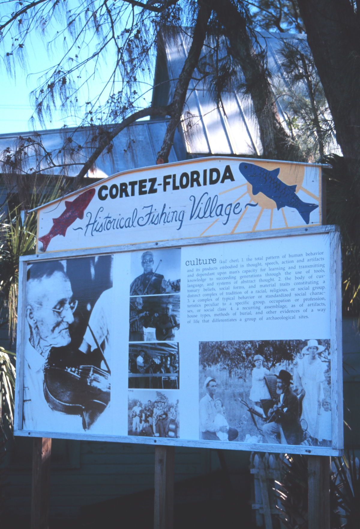
The cape before NASA : Cape Canaveral the fishing village
Before the launch pads, a few hundred people lived on the cape. They fished, ran orange groves, kept the lighthouse, buried their dead in two cemeteries on the dunes. The federal government bought most of them out in 1949.
Before the Air Force bought it, the cape was a small fishing and citrus community of maybe 250 to 300 year-round residents. The community had a name (Artesia, from the natural artesian wells near the lighthouse), two cemeteries, a one-room schoolhouse, a packing house for citrus, and a post office. The Wilson family was the largest landholder with about 1,300 acres of orange groves. Most other families had 5 to 50 acres. The 1949 condemnation proceedings bought out almost everyone at prices averaging $200 per acre. By 1953, the cape was federal land. The two cemeteries remained, accessible by escort. The rest of the village was bulldozed for launch complexes.
Who lived there
The earliest permanent settlers came in the 1840s and 1850s, drawn by the same federal homestead patents that had opened most of Florida. Records held by the Brevard County Property Appraiser show land patents granted to about a dozen families between 1845 and 1875. The Wilson, Burnham, Penny, Quarterman, Stone, and Honeywell names appear most often.
Mills Olcott Burnham, the lighthouse keeper from 1850 to 1886, raised his family at the light station. The Wilson family established the orange groves that became the cape’s largest commercial operation. The Honeywell family ran the post office out of a wooden shed near the lighthouse from 1885 through 1929.
The 1900 census recorded 187 people on the cape proper. The 1940 census recorded about 215. The number swelled during winter, when the families took in fishing tourists from northern states, and shrank in summer when the heat and mosquitoes drove the seasonal residents away.
What they did
Citrus was the main commercial activity. The cape’s sandy soil, frost-free climate, and rail access via the Florida East Coast Railway made it economically viable for orange production. The Wilson groves shipped about 8,000 boxes annually in the 1930s, most going to New York and Philadelphia.
Fishing was the second economy. The Banana River and the offshore Atlantic produced mullet, snapper, grouper, and shrimp. The cape had two small fishing camps that catered to visiting sportsmen, and the year-round residents fished for table and market.
Lighthouse-keeping was the third. The Coast Guard ran the station with three keepers and their families. The keepers had quarters, gardens, and a small school for the children.
Boatbuilding, basket-weaving, and a small turpentine operation rounded out the economy. The cape was poor by national standards but largely self-sufficient.
The schoolhouse and churches
Cape School #2 opened in 1898 in a one-room wooden building near the lighthouse. It served roughly 20 students at a time across all grades, taught by a single teacher hired by the Brevard County school board. The school closed in 1949 when the land acquisition began.
There were two small churches: a Methodist congregation that met in a converted citrus packing house, and a Baptist mission that met in a member’s home. Neither had a full-time minister. Circuit preachers visited monthly.
The two cemeteries
Two cemeteries served the cape’s dead. The older, on a small rise near the lighthouse, held burials from the 1850s through about 1910. The newer, near the Wilson grove, held burials from 1900 through 1949. Combined, the two cemeteries contain about 80 marked graves and an unknown number of unmarked.
Both cemeteries are still there. They sit on what is now Cape Canaveral Space Force Station land. Descendants of the buried can request access, escorted by the 45th Space Wing security, on family-visit days arranged through the cape historical office. Federal law (the National Historic Preservation Act and various burial-protection statutes) prevents the graves from being moved or built over.
The cemeteries are the cape’s only surviving pre-1949 civilian features.
The 1949 land acquisition
The Air Force began acquiring the cape’s private parcels in late 1949 after the Joint Long Range Proving Ground was established. The condemnation proceedings worked through the federal district court in Tampa. About 40 separate property owners were named in the actions.
The condemnation values were low. The Air Force appraisers valued the citrus groves at about $200 per acre on the theory that the cape’s commercial agriculture was marginal. The Wilson family contested the appraisal. Their case went to a federal jury in 1951. The jury awarded $445 per acre, more than double the Air Force offer. Most other families accepted the original offers rather than litigate.
The acquisition was effectively complete by 1953. A few small parcels held out into the mid-1950s, including the post office, which the Honeywell family retained until 1956. By 1960, the cape was fully federal except for the cemeteries and a small access easement to the lighthouse for the Coast Guard’s continued use.
What the displaced families did next
Most cape families relocated to Cocoa, Cocoa Beach, Titusville, or the small inland town of Mims. Henry Wilson III, born on the cape in 1937, eventually moved to Cocoa Beach and worked for the Air Force as a civilian range safety officer. He gave an oral history to the Brevard County Historical Commission in 1998 that runs to 142 transcribed pages. It is the single most detailed account of cape life before 1949.
Some families left Florida entirely. The Penny family moved to Georgia. The Quartermans moved to South Carolina. The Honeywells stayed in Brevard County and ran a small grocery in Cocoa through the 1980s.
The cape’s displaced families were never compensated for the loss of community, only for the loss of land. The cape’s small civic and economic life (the school, the churches, the post office, the seasonal fishing camp, the citrus economy) disappeared.
The City of Cape Canaveral
In 1962, the displaced cape residents and the new arrivals to the area incorporated the City of Cape Canaveral on the south end of the peninsula, outside the federal launch range. The new city was effectively a continuation of the old cape community in name and in some residents, though geographically distinct. The 1962 charter is its own piece of cape history and gets its own article on this site.
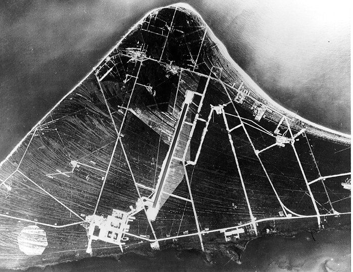
What the launch pads sit on
Every launch complex at Cape Canaveral Space Force Station sits on what was, in 1948, owned by somebody. Most of LC-39A and LC-39B (the Apollo and Shuttle pads) were Wilson grove. Most of the 1950s ICBM complexes (LC-13, LC-14, LC-19) were Penny, Stone, and Quarterman holdings. The land was bought, the people were moved, the rockets were built.
This is the cape’s other history. The launch history is well documented. The acquisition history is the quieter half. Both are on the same ground.