The Air Force Eastern Test Range : telemetry, range safety, downrange stations
Every cape launch depends on a 10,000-mile telemetry network running from Florida to the Indian Ocean. Antigua, Ascension, Diego Garcia. The cape's range is bigger than the cape.
The Air Force Eastern Test Range, redesignated the Eastern Range in 1990 and now operated by Space Launch Delta 45, is the 10,000-mile telemetry and range-safety corridor that runs from Cape Canaveral east-southeast across the Atlantic to the Indian Ocean. It exists because rocket launches can’t be flown blind. Every cape launch needs continuous radar tracking, telemetry reception, and range-safety command authority along the entire flight path. Through the 1960s and 1970s, the Eastern Test Range operated tracking stations on Grand Bahama, Antigua, Ascension Island, Pretoria, and the Indian Ocean island of Mauritius. Most are gone now, replaced by satellite-relay systems. A few survive.
The original network
When the Joint Long Range Proving Ground was established in 1949, the planners knew they would need downrange tracking. The Atlantic Missile Range was set up by the Air Force in 1950 to handle the function, with US State Department negotiations producing leases or access agreements with the British and other allies along the corridor.
By 1965, the operating Eastern Test Range tracking stations were:
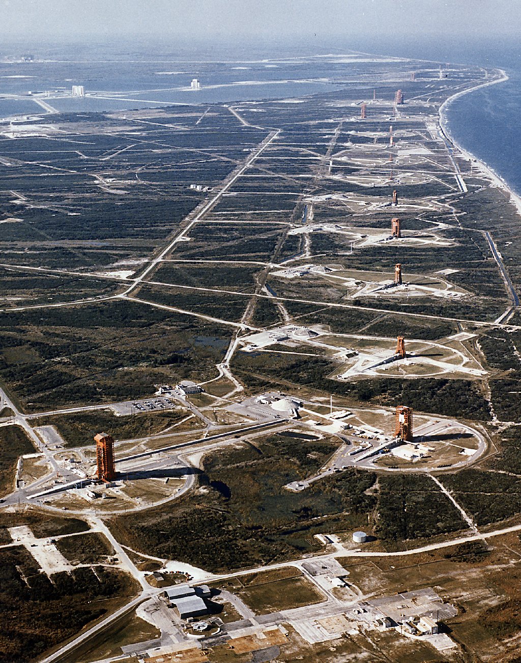
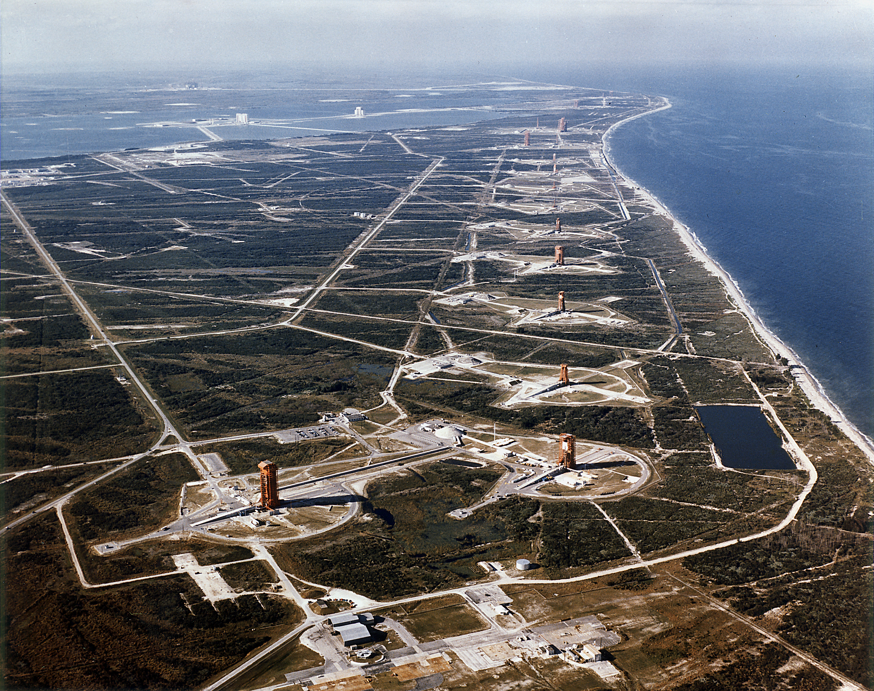
- Cape Canaveral (the launch site)
- Grand Bahama Island
- Eleuthera (Bahamas)
- Grand Turk (Turks and Caicos)
- Antigua
- Ascension Island (mid-Atlantic, British territory)
- Pretoria, South Africa
- Mahé, Seychelles
- Mauritius
- Mawson Station, Antarctica (occasional use)
Each station had radar dishes (typically 8-meter or 12-meter parabolic antennas), telemetry receivers, and a range-safety officer authorized to send a destruct command if the rocket veered off course.
The Ascension tour
The most-storied of these was Ascension. The British island, 1,000 miles west of the African coast, sat at the perfect midpoint of an Atlantic Missile Range trajectory. The cape’s launches passed within radar range of Ascension typically 18 to 22 minutes after liftoff.
The US negotiated access to Ascension under a 1956 agreement with the United Kingdom. The Air Force built a station on the island starting in 1957 and operated it continuously through the 1990s. The Ascension station’s tracking radars supported every Mercury, Gemini, Apollo, and early Shuttle mission.
Service at the Ascension station was a six-month rotation for Air Force personnel and civilian contractors. The island has no permanent civilian population in the modern sense; it was a working military and weather station. Recreation consisted of birding (the island is one of the most important seabird nesting sites in the Atlantic), fishing, and visiting the small Royal Air Force club.
The station closed in stages between 1999 and 2017 as satellite telemetry made physical downrange tracking optional. A small US presence remains for missile defense radar operations.
The Antigua station
The Antigua Air Force Station, on the British (now independent) island of Antigua, was the first major downrange station after Grand Bahama. The cape’s launches typically passed over Antigua 6 to 9 minutes after liftoff.
The Antigua station was active from 1957 through 2015. It tracked every crewed US launch from Mercury through the Shuttle program. At peak operations in the mid-1960s, the station employed about 400 Air Force, civilian contractor, and local Antiguan support staff.
The station’s role declined gradually after the 1990s. By 2005, most of its functions had been replaced by NASA’s Tracking and Data Relay Satellite System (TDRSS), which provides nearly continuous telemetry coverage from a constellation of geosynchronous relay satellites. The Antigua station closed in 2015. The land was returned to the government of Antigua and Barbuda.
Range safety
The other Eastern Range function, separate from telemetry, is range safety. Every launch from the cape carries a range-safety officer (RSO) authority. The RSO, sitting at a console at Patrick Space Force Base, watches the rocket’s actual trajectory against a predicted nominal trajectory. If the rocket deviates beyond a designated impact-protection envelope, the RSO can send a destruct command to terminate flight.
The destruct command sends a coded radio signal to explosive charges embedded in the rocket’s tanks. The charges rupture the propellant tanks, the rocket loses thrust, and the vehicle falls into the ocean rather than continuing toward populated areas.
The Eastern Range destruct authority has been exercised at least 17 times in the cape’s history. The most recent was the Antares NG-3 cargo flight on October 28, 2014. The most famous was the Vanguard TV-3 on December 6, 1957 (the rocket exploded on the pad without an RSO command; the explosion was due to engine failure). The cape’s worst pad disaster, the Apollo 1 fire in 1967, was not an RSO event; it happened during ground testing without the rocket flying.
Telemetry decline and replacement
The original Eastern Test Range was designed for the analog telemetry of the 1960s. The 8-meter and 12-meter parabolic antennas at Antigua and Ascension could receive S-band telemetry from a rocket and forward it back to the cape via leased trans-Atlantic cable. That model was state of the art in 1965.
By the 1980s, the model was obsolete. The Tracking and Data Relay Satellite System (TDRSS), with the first satellite launched in 1983, provided near-continuous coverage of Earth orbit through three or four geosynchronous relays. A spacecraft in orbit could maintain telemetry to Houston or Goddard without any downrange ground station’s help.
The physical Eastern Range tracking stations gradually became redundant. They were maintained through the 1990s as backup capability and for the few mission profiles (notably launches to highly inclined orbits or polar orbits from Vandenberg) where the TDRSS coverage gaps mattered. By 2010, most stations were shut down or moth-balled.
What survives
In 2026, the active Eastern Range physical infrastructure consists of:
- The Range Operations Control Center at Cape Canaveral Space Force Station
- Radar facilities at Patrick Space Force Base
- Antigua, returned to local government but with US-funded equipment maintenance through 2024
- Ascension, reduced to a small detachment focused on missile defense rather than launch tracking
- A few smaller facilities supporting specific missions
The 10,000-mile corridor is mostly an electromagnetic abstraction now. Where the 1960s required physical stations strung across the Atlantic and Indian Oceans, the 2020s use satellite relays and a much smaller ground footprint.
The Eastern Range still exists. It’s just smaller, automated, and less visible. Most of the cape’s launches go off with the public seeing only the rocket and the launch tower. The downrange infrastructure that catches the telemetry runs in the background.
Why this still matters
Two reasons.
First, the cape’s launches are still bound by the Eastern Range’s safety envelope. A Falcon 9 from LC-40 has to fly within the same eastward corridor every other cape launch has flown. The trajectory rules are old. They don’t change just because the propulsion is reusable.
Second, the network was a quiet diplomatic achievement. Standing up a string of tracking stations across British, French, and US-affiliated territories from the Bahamas to the Indian Ocean required 1950s diplomacy that the public never saw. Each lease, each access agreement, each Status of Forces understanding was its own State Department file. The Eastern Range was a 10,000-mile partnership, not just a Florida launch program.
The cape itself is the visible 1 percent of the launch network. The other 99 percent is downrange, and most of it has been retired.